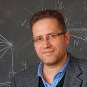
Paolo Addesso
[introductory/intermediate] Data Fusion for Remotely Sensed Data
Summary
Nowadays, a large number of different sensors provide a huge amount of data available to monitor the Earth surface. Typically, these data has different features, such as spatial resolutions, spectral characteristics and acquisition interval/revisit time. In this scenario, multisensor data fusion allows to properly combine the desirable feature from different sensors, and it is key in several applications, ranging from geology, agriculture, environmental sciences, urban monitoring, hazard management and so on. Therefore, after a proper introduction about the different kinds of sensors and the characteristics of the most popular acquired data, this course will be devoted to present the rationale of data fusion and its main applications. Then, the course will focus on three main data fusion examples, i.e. pansharpening, hyperspectral sharpening, and multi-temporal data fusion, providing useful insights about each of them and presenting some toolbox/code (mainly written in Matlab).
Syllabus
- Big data for remote sensing: a brief introduction.
- Sensors and remotely sensed data main characteristics/features.
- Data fusion for remotely sensed data with focus on:
- Pansharpening
- Hyperspectral sharpening
- Multi-temporal data fusion
References
[1] M. Chi, A. Plaza, J. A. Benediktsson, Z. Sun, J. Shen and Y. Zhu, “Big Data for Remote Sensing: Challenges and Opportunities,” in Proceedings of the IEEE, vol. 104, no. 11, pp. 2207-2219, November 2016, doi: 10.1109/JPROC.2016.2598228.
[2] G. Vivone et al., “A New Benchmark Based on Recent Advances in Multispectral Pansharpening: Revisiting pansharpening with classical and emerging pansharpening methods,” in IEEE Geoscience and Remote Sensing Magazine, vol. 9, no. 1, March 2021, doi: 10.1109/MGRS.2020.3019315.
[3] L. Loncan et al., “Hyperspectral Pansharpening: A Review,” in IEEE Geoscience and Remote Sensing Magazine, vol. 3, no. 3, pp. 27-46, September 2015, doi: 10.1109/MGRS.2015.2440094.
[4] P. Ghamisi et al., “Multisource and Multitemporal Data Fusion in Remote Sensing: A Comprehensive Review of the State of the Art,” in IEEE Geoscience and Remote Sensing Magazine, vol. 7, no. 1, pp. 6-39, March 2019, doi: 10.1109/MGRS.2018.2890023.
[5] G. Vivone, M. Dalla Mura, A. Garzelli and F. Pacifici, “A Benchmarking Protocol for Pansharpening: Dataset, Preprocessing, and Quality Assessment,” in IEEE Journal of Selected Topics in Applied Earth Observations and Remote Sensing, vol. 14, pp. 6102-6118, 2021, doi: 10.1109/JSTARS.2021.3086877.
[6] G. Vivone, A. Garzelli, Y. Xu, W. Liao and J. Chanussot, “Panchromatic and Hyperspectral Image Fusion: Outcome of the 2022 WHISPERS Hyperspectral Pansharpening Challenge,” in IEEE Journal of Selected Topics in Applied Earth Observations and Remote Sensing, vol. 16, pp. 166-179, 2023, doi: 10.1109/JSTARS.2022.3220974.
[7] R. Restaino, G. Vivone, P. Addesso and J. Chanussot, “A Pansharpening Approach Based on Multiple Linear Regression Estimation of Injection Coefficients,” in IEEE Geoscience and Remote Sensing Letters, vol. 17, no. 1, pp. 102-106, January 2020, doi: 10.1109/LGRS.2019.2914093.
[8] P. Addesso, G. Vivone, R. Restaino and J. Chanussot, “A Data-Driven Model-Based Regression Applied to Panchromatic Sharpening,” in IEEE Transactions on Image Processing, vol. 29, pp. 7779-7794, 2020, doi: 10.1109/TIP.2020.3007824.
[9] M. Carpentiero, G. Vivone, R. Restaino, P. Addesso and J. Chanussot, “An Optimization Procedure for Robust Regression-Based Pansharpening,” in IEEE Transactions on Geoscience and Remote Sensing, vol. 60, pp. 1-16, 2022, art. no. 5410416, doi: 10.1109/TGRS.2022.3179105.
[10] R. Restaino, G. Vivone, P. Addesso and J. Chanussot, “Hyperspectral Sharpening Approaches Using Satellite Multiplatform Data,” in IEEE Transactions on Geoscience and Remote Sensing, vol. 59, no. 1, pp. 578-596, January 2021, doi: 10.1109/TGRS.2020.3000267.
[11] P. Addesso, M. Longo, R. Restaino and G. Vivone, “Sequential Bayesian Methods for Resolution Enhancement of TIR Image Sequences,” in IEEE Journal of Selected Topics in Applied Earth Observations and Remote Sensing, vol. 8, no. 1, pp. 233-243, January 2015, doi: 10.1109/JSTARS.2014.2321332.
[12] P. Addesso, M. Longo, A. Maltese, R. Restaino and G. Vivone, “Batch Methods for Resolution Enhancement of TIR Image Sequences,” in IEEE Journal of Selected Topics in Applied Earth Observations and Remote Sensing, vol. 8, no. 7, pp. 3372-3385, July 2015, doi: 10.1109/JSTARS.2015.2440333.
[13] P. Addesso, M. Longo, R. Montone, R. Restaino, G. Vivone, “Interpolation and combination rules for the temporal and spatial enhancement of SEVIRI and MODIS thermal image sequences”, in International Journal of Remote Sensing, vol. 38, no. 7, pp. 1889-1911, 2017, doi: 10.1080/01431161.2017.1283075.
[14] P. Addesso, M. Longo, R. Restaino and G. Vivone, “Spatio-temporal resolution enhancement for cloudy thermal sequences”, in European Journal of Remote Sensing, vol. 52, issue sup1, pp. 2-14, 2019, doi: 10.1080/22797254.2018.1526045.
Pre-requisites
Familiarity with basics of image processing and Matlab.
Short bio
Paolo Addesso is an Associate Professor with the University of Salerno (Italy) since 2022. He was a member of the LIGO Scientific Collaboration (LSC) from 2012 to 2019, and he is currently member of the Virgo Scientific Collaboration (VSC). Within LSC, he was co-recipient of two International Prizes: 2016 Special Breakthrough Prize in Fundamental Physics and 2016 Gruber Cosmology Prize for being co-author of the paper describing the discovery of gravitational waves, i.e. “Observation of Gravitational Waves from a Binary Black Hole Merger”, B. P. Abbott et al. (LIGO Scientific Collaboration and Virgo Collaboration), Phys. Rev. Lett. 116, 061102 – 11 February 2016. In 2017, Paolo Addesso also won a grant as Visiting Professor at GIPSA-lab, Université Grenoble Alpes (France), for the research project “Data Fusion and Image Analysis for Remote Sensing”, in collaboration with Mauro Dalla Mura and Laurent Condat. Currently, he is editor of the international journals MDPI “Remote Sensing” and MDPI “Eng”. His research interests include remote sensing, detection and estimation theory, signal processing, multiterminal inference, statistical characterization of nonlinear devices and gravitational waves detection.


